
Humans have made a long way from looking to the skies since the ancient times. Ancient sailors of history only relied on the constellations of the night sky to figure out where they were and where they were going. Today, all we need is a simple, hand-held GPS receiver to know exactly where we are on the planet. But now, instead of looking to the stars, we rely on satellites, which are still objects in the sky.
What is GPS?
GPS, which stands for Global Positioning System, is a satellite-based navigation system. It provides location and time information anywhere or near the earth where there’s an unobstructed line of sight to four or more GPS satellites. Obstructions like mountains and buildings block the weak GPS signals.
GPS doesn’t require the user to transmit any data, plus it operates independently from any telephonic or internet reception, though these services can enhance the usefulness of GPS information. GPS works in any weather conditions, 24 hours a day, anywhere in the world.
The US government, specifically the United States Air Force, owns and operates GPS. They also maintain it and make it freely accessible to anyone with a GPS device. The GPS project was initially headed by the US Department of Defense (USDOD), and they put up the satellites into orbit for military use. Nowadays, GPS is available for civilian use, as long as you have a GPS device. If you like watches and fitness trackers, here are some GPS-enabled accessories that can help in your navigation needs. https://criticsrant.com/gps-technology-and-fitness-watches/
Generally, there are five critical purposes of GPS:
- Location
- Navigation
- Tracking
- Mapping
- Timing
These key uses of GPS are extremely relevant today and are used in numerous industries that are creating accurate surveys and maps, tracking position and location, navigating, and taking precise time measurements, like, for instance, how long will it take to go from one point to another.
There are other similar navigation systems in the world, and it’s not just the one from the United States. There is GLONASS, which is a satellite constellation system built by Russia. The European Space Agency has Galileo, while China has BeiDou. There are receivers that can track both GPS and GLONASS, and some can even track BeiDou.
GPS has revolutionized businesses nowadays , and if you want to create your own app, you should have the necessary tools to develop an effective one, you can check this website zipcodebase.com for more information.
The basic structure of GPS
GPS works through these three important segments:
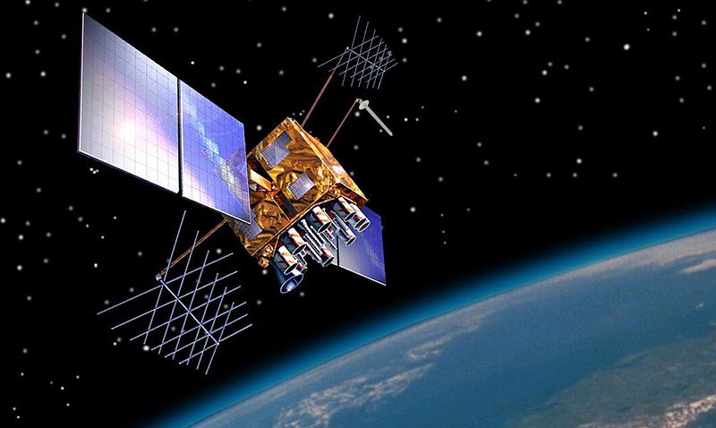
1. Space segments (GPS satellites)
These consist of a nominal constellation of 24 operating satellites that transmit one-way signals that indicate the GPS satellite position and time. GPS satellites are deployed on six orbits around the earth at the altitude of around 20,000 and move around the earth at 12-hour intervals. It comes with four GPS satellites per orbit.
2. Control segment (Ground control stations)
These are monitor and control stations scattered worldwide. These stations play a role in monitoring, controlling, and maintaining satellites to keep them in their proper orbits. The technology and operators in the control stations make sure that they maintain the satellites in their proper orbits through occasional command maneuvers. They make sure that the deviation of satellites from the orbit and GPS timing is within the tolerance level. They also track the GPS satellites, uploads navigational data, and maintains the good status of a satellite constellation.
3. User segment (GPS receivers)
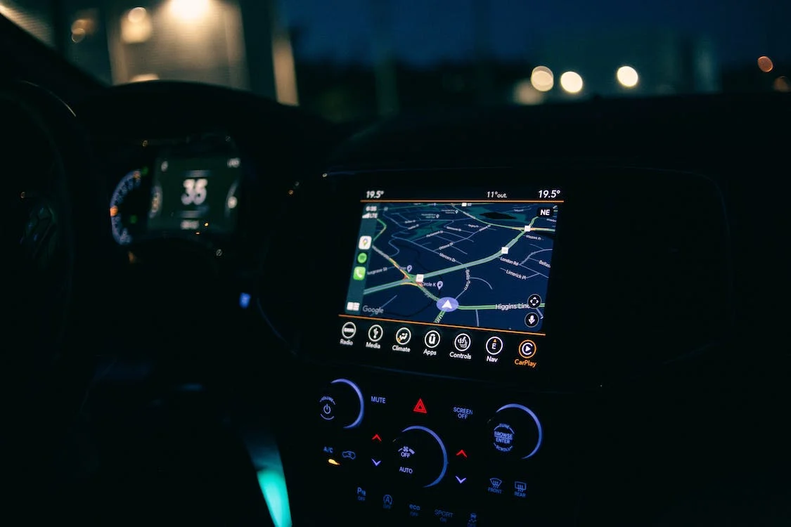
These are devices that receive the signal, like your GPS tracker in your phone or car. These devices constantly listen to the signal from these satellites, and the receiver can figure out how far away they are from some of them.
How does GPS work?
Here’s the short answer: the space segments (or GPS satellite) constantly sends out signals, then a GPS receiver listens for these signals. Once the receiver calculates the distance from four or more GPS satellites, it can figure out your location.
But here is the more detailed answer. A series of GPS satellites orbiting the earth are sending unique signals that are read and interpreted by a GPS receiver located on or near the surface of the earth. To calculate location, the GPS device reads the signal from at least four satellites. Each satellite in the network circles the earth twice a day in a precise orbit, and each of them sends a unique signal, time, and orbital parameters. At any given time, a GPS device can read signals from four or more satellites.
Essentially, the GPS receiver measures the distance of each satellite through the amount of time it takes to receive a transmitted signal. The receiver can determine their position through the distance measurements from a few more satellites, and it can display the information electronically, so you can measure your running route, find your way to the restaurant, or map a golf course.
A satellite broadcasts a microwave signal, which is caught by a GPS device. The satellite uses it to calculate the distance from a device to the satellite. Since a GPS device can only give information about the distance from a satellite, a single satellite can’t provide much information in terms of location.
To be able to perform GPS positioning, the signal of time is sent from a satellite at a given point. Then, the time difference between the GPS time and the point of time clock from the GPS receiver will be calculated. This generates the distance from the GPS receiver to three other available satellites.
What are GPS signals?
GPS satellites broadcast at least two low-power radio signals. These signals travel by line of sight, so they can pass through glass, clouds, and plastic, but may not go through solid obstructions like tall buildings and mountains. However, modern GPS devices nowadays are more sensitive and are able to track through houses.
A GPS signal contains these types of information:
1. Ephemeris data: Ephemeris is the data of the orbit of each satellite. It provides a precise orbit for the satellite itself to provide the satellite’s position. It gives important information, such as time, current date, and health of the satellite. These data are used only by each of the GPS satellites with a specific ID number.
2. Almanac data: This is the data of orbit of all satellites. It’s the simplified ephemeris data that contains orbit course and orbital information for that satellite and every other satellite in the system. It locates available satellites so that a GPS receiver can generate current location and time, at any given time throughout the day.
3. Pseudorandom code: This is the identification code for the satellites that identify which satellite is transmitting the information. A GPS device can show which satellites you are getting signals from by looking at the device’s satellite page.
How accurate is GPS?
Today, GPS receivers are extremely accurate because of the parallel multi-channel design. GPS receivers are now quick to lock onto satellites when turned on, maintaining a lock even in dense tree-covered locations, or in urban cities with tall buildings.
The accuracy of the GPS device still depends on many variables: the environment, the ionosphere, and of course, the number of satellites available. For instance, accuracy tends to be higher in open areas with no mountains or adjacent tall buildings. When the GPS device is surrounded by large buildings, like in Manhattan, the satellite signal can be blocked by buildings and then bounced off the building where it can be read by the device.
Generally, high-quality GPS receivers can provide more than 2.2-meter horizontal accuracy in 95% of cases. Things that can cause accuracy in GPS devices to include:
1. Signal arrival time measurements: These are delays that happen when the signal reflects off objects such as mountains and tall buildings before it reaches the receiver.
2. Atmospheric delays: These are delays caused by solar storms, heavy storm cover, and ionospheric delays. It happens when satellite signals slow down as they pass through the abnormalities in the atmosphere.
3. Receiver clock: Slight timing errors can happen because a receiver’s built-in clock is less accurate than the atomic clocks on the GPS satellites.
4. The number of satellites visible: The more satellites a receiver can “see,” the more accurate the GPS positioning becomes. When a signal is blocked, you may get position errors, or even no position reading at all.
5. Satellite geometry or shading: Satellite signals become more accurate and effective when satellites are located at wide angles relative to one another, rather than in a tight grouping or a line.
6. Artificial interference: Other devices can cause errors in GPS positioning, like GPS jamming devices or spoofs.