


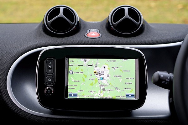
When you drive to a place you haven’t been to, you rely on GPS on your car to lead you to your destination. When you’re travelling alone, you check the map on your phone and activate your GPS. When you’ve lost your iPhone, you are thankful that you have a GPS tracker to find your device.
We have all benefited from GPS, but have you ever thought how it came to be? Now, here’s your answer.
What is GPS?
GPS, or Global Positioning System, is a global navigation satellite system that is relied on by almost every industry today. It’s a positioning, navigation, and timing service based on 24 operational satellites owned by the US and managed worldwide by control stations. The satellite system consists of six earth-centered orbits, each with four satellites. It’s operational 24/7 and in almost all weather conditions.
GPS is previously reserved for military use, and now it’s available to everyone. All in all, there are 31 operational satellites in the GPS constellation, with 3-5 additional satellites in reserve that can be activated when needed.
History of GPS
Initially created by the US Department of Defense, GPS was launched in 1973 to overcome the limitations of the past navigation systems. The design of GPS is based partly on other ground-based radio navigation systems, such as the Decca Navigator and the LORAN, which were developed in the early 1940s.
In 1957, the Soviet Union launched the Sputnik I satellite, making it a solution for developing better geolocation technology. Two American physicists, George Weiffenbach and William Guier at Johns Hopkins University’s Applied Physics Lab (APL) decided to monitor its radio transmissions. Within hours, they realized that because of the Doppler effect, they could pinpoint where the satellite was along its orbit.
When the deputy director of the APL asked the physicists to investigate the inverse problem. That time, the US Navy began tracking submarines with satellite navigation. This led them to develop the TRANSIT system, which used used a constellation of five satellites and could provide a navigational fix around once per hour. It was first successfully tested in 1960.
However, updates from the US Navy TRANSIT system were too slow for the high speed action of Air Force operations. The Naval Research Laboratory made advancements with their Time Navigation satellites, which was first launched in 1967. The third one launched in 1974 carried the first atomic clock into the orbit of the earth.
The United States Department of Defense sought a reliable method of location, so they initiated the GPS or Navigation System with Timing and Ranging (NAVSTAR) project in the early 1970s. In 1978, NAVSTAR Block I GPS was launched with only four satellites at the time.
In 1983, Korean Airlines Flight 007 was shot down after straying into the prohibited airspace of the USSR. It carried 269 people. Because of this President Ronald Reagan issued a directive to make GPS freely available for civilian use once it was sufficiently developed. This led to the development of commercial GPS tracking. If you are planning to travel to Australia, make sure to understand the gps tracking laws implemented in that country.
The first GPS receiver for use by consumers was developed by Magellan. In 1989, Magellan introduced NAV 1000, which was the first hand-held GPS device. It weighs 1.5 pounds and costed $3,000 to run for a couple of hours at a time. The high cost of satellite navigation meant that besides the military, only freight, delivery companies, and others could afford to use the system. In the same year, the first Block II satellite was launched.
GPS accuracy improved over the years, and as it did, many industries took advantage. In the early 1990s, GPS services were originally partitioned into the Precise Positioning Service (PPS) for military use, and the Standard Positioning Service (SPS) intended for the public. Despite some of the limitations in accuracy and coverage, GPS played a significant role in military operations, like during the Gulf War in 1990 to 1991.
In 1993, the US Air Force launched the 24th NAVSTAR satellite into orbit, completing the network of 24 satellites, which is known as the GPS that is today. GPS receivers that time costs less than a few hundred dollars, and you can instantly learn your location on the planet to within a few hundred feet.
The Department of Defense intentionally made the GPS signal for SPS to be less accurate and called it Selective Availability. This changed when President Bill Clinton signed a policy directive in 2000 to turn off selective availability and provide the same GPS accuracy to civilians that was afforded to the military. This is why our GPS receivers have become so accurate today. Moreover, the US military was actively developing technologies to deny GPS service to potential enemies on a regional basis.
Over the years, the capabilities of technology continues to expand. In 2004, Qualcomm successfully completed its test of live-assisted GPS on a mobile phone – which is the technology that evolved in to the GPS that we enjoy with our smartphones today. In 2008, the Block II satellites were launched, and was followed by the GPS IIF satellite in 2016.
Applications of GPS
GPS is extremely relevant today and it’s used in numerous industries such as mobile communications, sales and services, security, agriculture, autonomous vehicles, drones, fishing, and military. Its key uses include:
1. Locating positions
Determining, locating, and tracking positions is the main and most common application of GPS. If you’re going on a road trip, traveling to a place you aren’t familiar with, and going on an adventure, GPS can help you find another location. It can assist you to arrive at your destination safely and on time, as it shows the best routes or shortcuts available.
2. Emergency response
In case you encounter an emergency or an accident in an isolated area and you need immediate assistance, first responders can use GPS for mapping. With GPS, an emergency crew will be able to trace your current location even without receiving location details from you. You can simply call pre-programmed emergency numbers on your phone, and a team will be able to immediately assist you.
3. Tracking for law enforcement
The police, not just the military, takes advantage on GPS. GPS devices are used by the police and investigators in catching criminals. They only need to attach a tiny GPS tracking device on the suspect’s vehicle to track their whereabouts. It can also help them collect useful evidences. Their GPS trackers can also help Special Forces and their commanders to monitor the police’s movements, whether they are safe or will need backup.
4. Mapping and surveying
GPS is used extensively for mapping and surveying projects. It saves companies time and expenses, while being able to survey positions in the shortest time possible. It helps in building highways, dams, crops, power lines, soil types, rivers and more.
5. Preventing theft and retrieving lost items
GPS works as an excellent anti-theft device. Installing tracking device on your vehicles or phones allows you to trace and locate it in case it has been stolen. There are a lot of several reports of recovered stolen phones and vehicles because of GPS technology.
6. Travel
Maps are generally used when planning trips, and GPS is used to locate camping sites, rest points, runs, and other significant locations. A GPS tracker is especially useful for solo travelers, so in case something unfortunate happens, the solo traveler will be located immediately, and help can come before anything is too late.
7. Aircraft routes
Planes use GPS in finding their route into the atmosphere, since there are no visible roads unlike when travelling on land. With GPS, commanding stations will be able to keep track of their planes’ movements and routes. If an unfortunate event like a crash happens, the plane’s flight data recorder with GPS tracker can help the commanding station to easily locate it when missing.
8. Keeping tabs on the elderly and the disabled
One of the widely known applications of GPS on homecare is keeping tabs on the elderly, especially those with dementia. GPS helps you take care of a senior family member who has a tendency to wander to random places alone and have difficulty finding their way back home. These GPS devices come with an emergency button that allows them to call for help. Some comes in an inconspicuous form inserted on the clothes or footwear of an elderly family member.
9. Fitness tracking
Fitness-oriented people benefit from fitness trackers with GPS, as it offers accurate workout tracking. GPS is used in distance and step tracking, and in providing precise real time pace as you move. It gives the wearer a bigger sense of what a person accomplishes with his/her fitness regimen. If you’re looking for the best fitness trackers with GPS functionality, check out some of our top picks.